Short Path
Find shortest path between points based on line (network) layer.
Using Dijkstra's algorithm
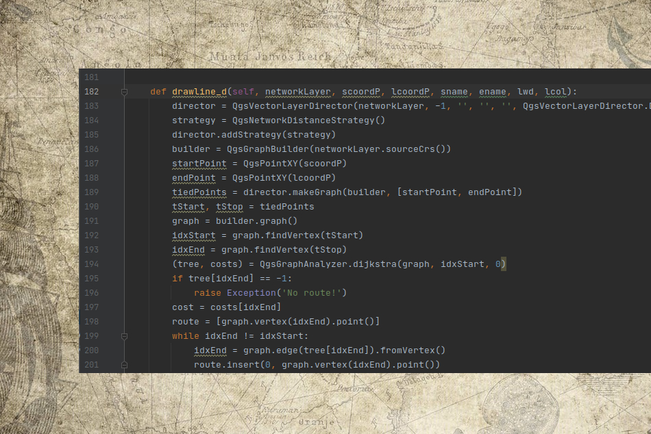
Python
This plugin is built with QGIS's plugin builder 3. It is mainly written with python, using PYQGIS library which is very powerful library. It has very intuitive GUI and is well documented. PYQGIS library also has good and wide organised documentation.
Inspiration
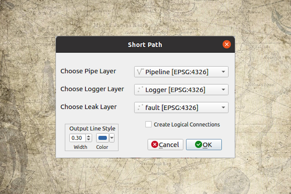
To build this plugin was inspired by water pipeline maintenence process. The logic is to add three layers to the project: 1) Network (pipeline) layer; 2) Logger (sensor) layer; 3) Leak (damage) layer; System looks at Leak layer's attribute table, finds logger_id and based on the network layer's geography it creates new memory layer with same attributes as network layer. Also, system adds full length column.
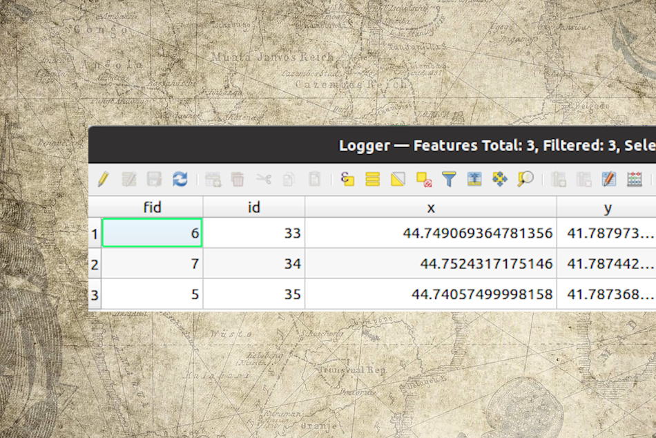
Logger
Logger layer is a point layer which shows sensors locations on the map. It's important to maintain the structure of attributes of this layer as it's used for connection finding logic. First four attributes and their order are mandatory for this layer. After these four attributes, you can add as many columns as you need.
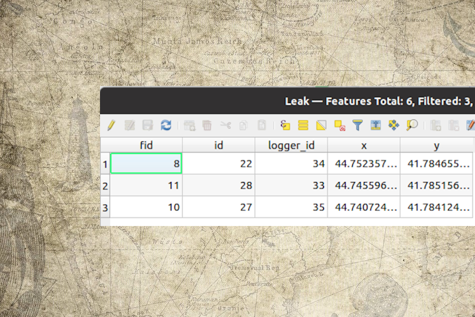
Leak
Leak layer is a point layer which shows damaged points of pipeline. It's important to maintain the structure of attributes of this layer as it's used for connection finding logic. First five attributes and their order are mandatory for this layer. After these five attributes, you can add as many columns as you need.
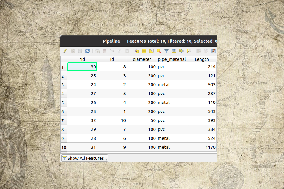
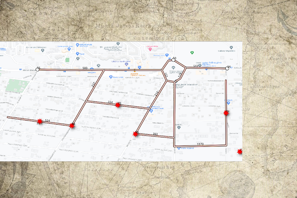
Network
Network (pipeline) layer is a line layer used for path generation between points. It can include any attributes which will be copied by plugin to the newly generated, shortest path layers.
Menu
Plugin menu shows three layers dropdown list with layer name and crs. It allows you to check logical connection generation checkbow which adds direct (logical) connections between points.
Download test layers package here: test_net.zip
Background
Image by PublicDomainPictures from Pixabay
Image by M. H. from Pixabay
Keep in touch
Please, message us if you have any thoughts.
humanovirtual
I'm mapping and scripting enthusiast. This is my first QGIS plugin but if you have any idea or needs to built new plugin, we can discuss details. Somtimes people can't imagine how wide is automation capabilities. So, never stop imagination and always ask "is it possible to..."
You can find me on reddit and see my r/SLRep there.
Email: rewaza@gmail.com
Copyright © 2021 Short Path